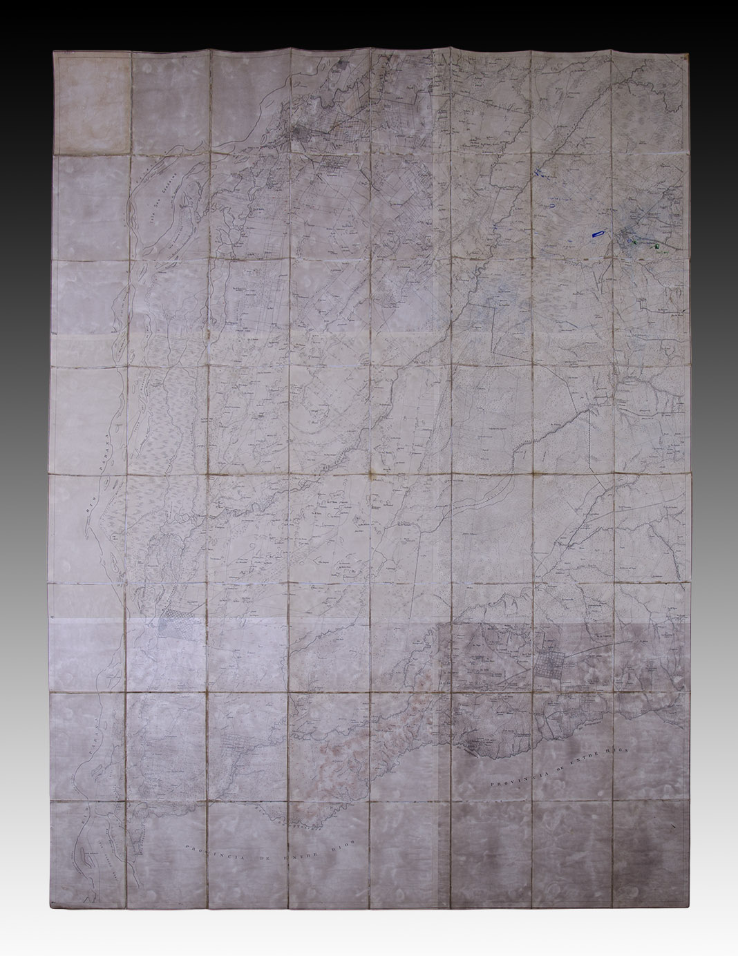
Province of Corrientes. Center and Southwest of it. Circa 1897.
Large cadastral map of the province of Corrientes, lined, folded, with its cover restored. Exemplary in good shape, although somewhat toasted. Measurements: 171 x 125 cm / 67.32 x 49.21 in.
The chart extends with the following limits: towards the West of the Paraná River, towards the South with the province of Entre Ríos, towards the North until the 29th parallel and towards the East, until the longitude of 58 ° 30´. Precisely in the northwest corner and very close to the town of Perugorria there are a few annotations in ink indicating some lots and in one, with the observation of Horses and troops. I".
Without authorship references, we can venture that this work is linked to the great Map that Zacarías Sánchez announced when he published his book "Notes descriptive of the Province of Corrientes complementary to the Geographical Chart" in 1894.
Unfortunately, its original Cover has been lost, so that we infer this possibility in the case of a meticulous cartographic work and that of Sánchez being the most important for the time. The truth is that the map itself has the wealth of information on the towns, roads, railways and names of estancias, just as the author indicated in his book does, also offered for sale in this auction. In the upper right corner (Northeast of the letter) there is a railway branch (under construction?) That indicates from Chavarria to Yofre; These two stations of the Argentine Northeast Railroad were enabled in 1901, although the stations were built a few years before; that of Chavarría, for example, in 1898.
S.O-XIV-DDM
Are you interested in selling some works?
Send us an email briefly indicating
which works you intend to put on sale, and we will respond. click here
Subscribe to our newsletter to be updated.
Check our Newsletters