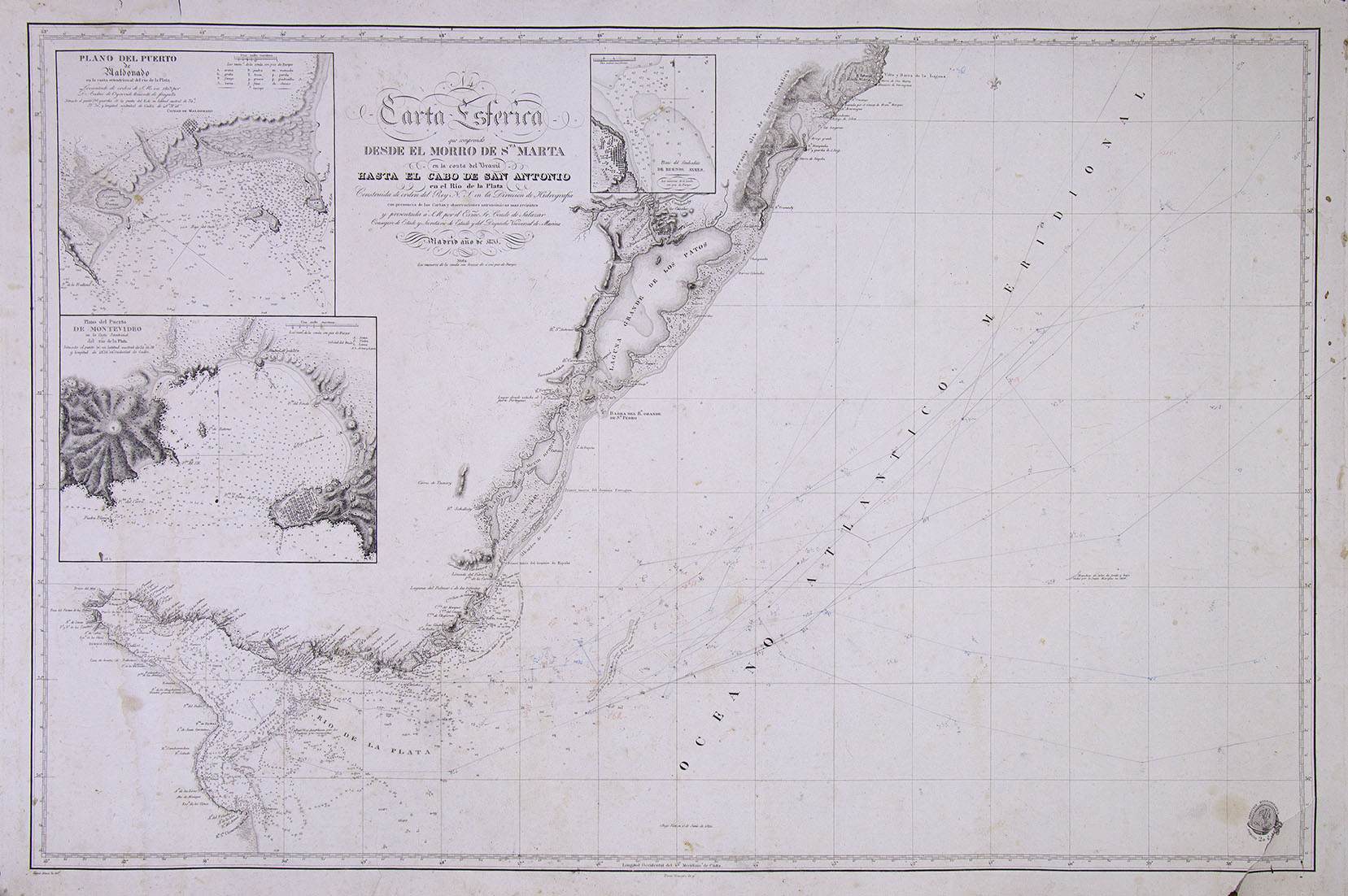
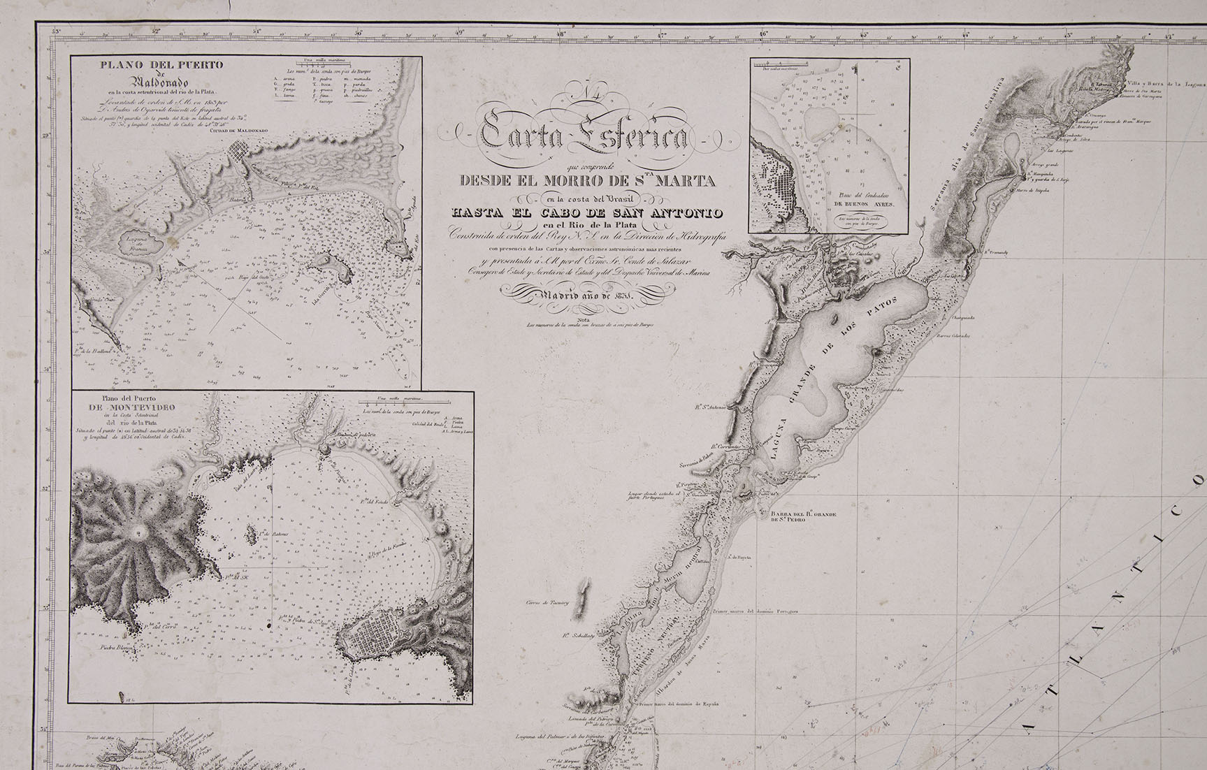
Carta Esférica que comprende desde el Morro (...). 1831.
Carta Esférica que comprende desde el Morro de de Sta Marta en la costa del Brasil hasta el Cabo de San Antonio en el Río de la Plata. Construida por orden del Rey N. S. en la Dirección de Hidrografía (...) presentada á S. M. por el Exmo Sr. Conde de Salazar (...) Departamento Hidrográfico. Madrid año de 1831.
Engraving on paper. At the foot of it, from left to right: Gaspar Massa la del.ó, and Tomas Gonzalez la g.ó, indicating who the authors of the drawing and engraving were. Paper measurements: 67 x 103.5 cm. Specimen with some marginal losses. It is displayed framed.
Scarce Spanish Maritime Chart of the southern coast of Brazil and the Río de la Plata, published by the Hydrographic Department of Spain. Essential auxiliaries for sailors, these charts fulfilled a noble mission that went beyond Spanish-flagged vessels. In the Argentine Confederation, its most relevant authority was at that time the governor of Buenos Aires, Juan Manuel de Rosas.
The graph includes large boxes of Montevideo, Buenos Ayres and Puerto Maldonado, and extends along the Argentine coast just south of San Clemente del Tuyú, at the southern end of the Samborombón Bay.
Are you interested in selling some works?
Send us an email briefly indicating
which works you intend to put on sale, and we will respond. click here
Subscribe to our newsletter to be updated.
Check our Newsletters