IN SOUTHERN PATAGONIA
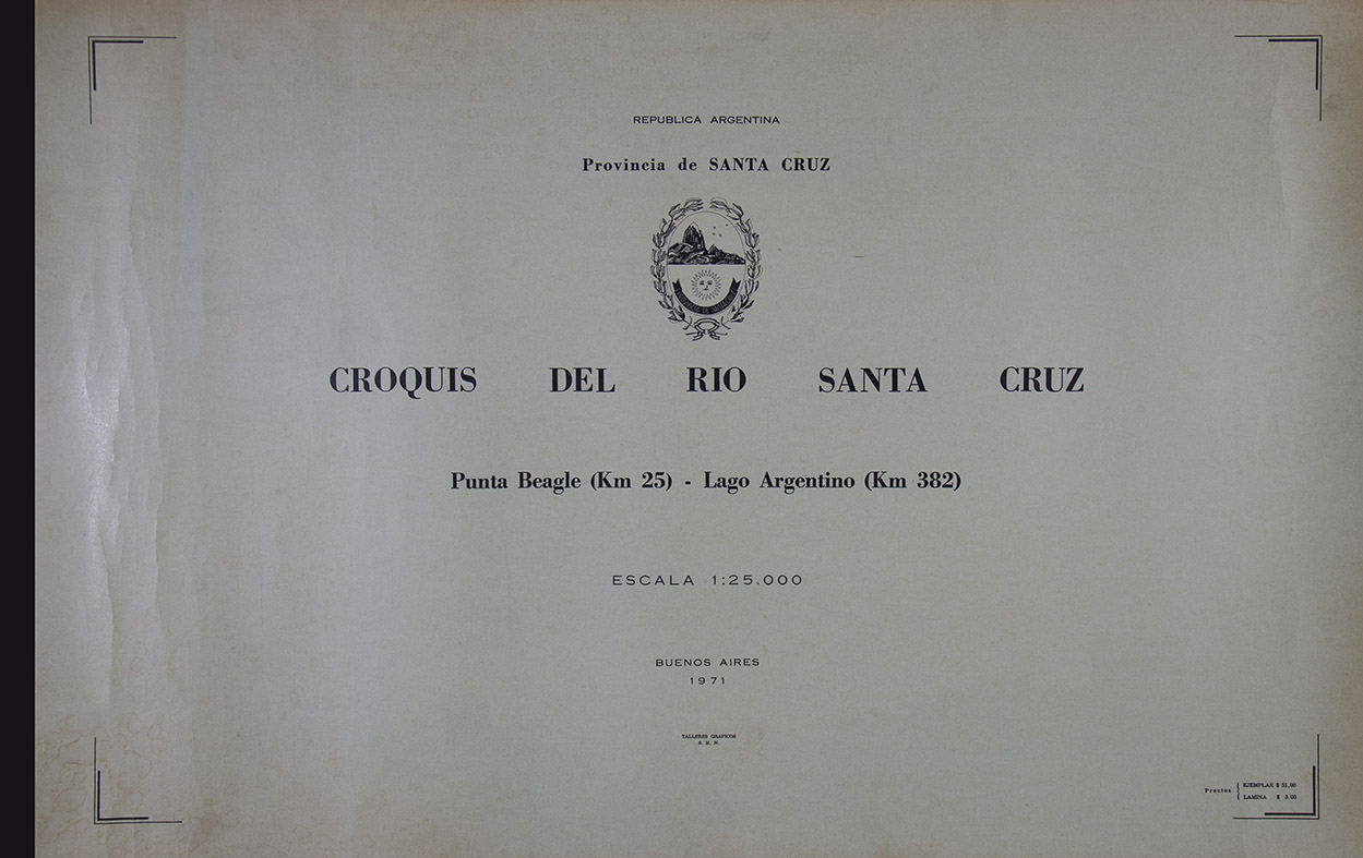
Sketch of the Santa Cruz River. Punta Beagle (Km 25) - Lago Argentino (km 382). Province of Santa Cruz. Argentinian republic. Buenos Aires. Graphic Workshops Naval Hydrography Service. 1971.
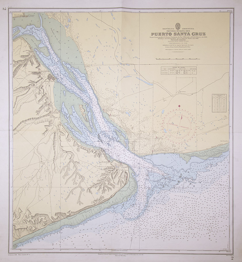
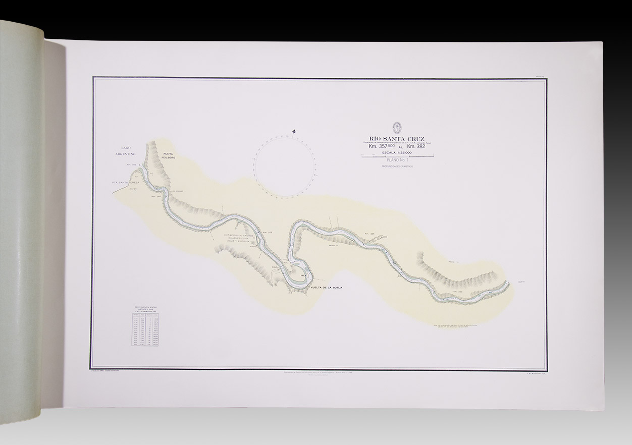
Large album (61 x 97 cm), with 17 plans made by the following cartographers: J. M. Mazzuco; Daniel Behrensen; George Keller; Rolando Gómez and A. Britos. Plus, the Map corresponding to the port of Santa Cruz, with the mouth of the homonymous River, thus completing its entire route. Specimen in great condition.
The set presents the hydrography of one of the main watercourses of the Argentine southern Patagonia. On the banks of that river is the city of Santa Cruz, the provincial capital. The complementary map was drawn by the Bahía Blanca hydrographic vessel in the years 1944/1945, and carried out by the cartographer P. Brito. It was published in 1948.
Are you interested in selling some works?
Send us an email briefly indicating
which works you intend to put on sale, and we will respond. click here
Subscribe to our newsletter to be updated.
Check our Newsletters